Monday, June 2, 2014

Training for my New... Whatever-I-Want

Before I started climbing I had spent over a decade of my life training for distance running, races ranging anywhere from 2 to more than 30 minutes. During that period I also studied human physiology at university. As a result, the method and science of how you train is more than just a passing interest for me.

When Steve House and Scott Johnston came out with their book, Training for the New Alpinism, I immediately got a copy and read it cover to cover. At this point if you're interested in such things you've probably already flicked through it yourself. There have been plenty of positive reviews so I'm not going to review it here (though it is the best book I've read on the subject, and I've read every single text that they reference and then some). Instead I'm going to briefly discuss how I used their expertise to create my own training, which is essentially why they wrote the volume. So, here after I will assume that you are familiar with Training for the New Alpinism or are at least familiar with endurance and strength training concepts.

Since starting climbing my training has definitely been a little ad hoc, though somewhat consistent. I had a list of workouts that I felt I should be doing and I tried to do each one once a week. The list included endurance laps at the gym, climbing outside, hill running, general strength maintenance exercises, etc. I would then try to get out in the mountains to tick off objectives whenever the conditions were good and I had time. I kept a training log during this time, mainly because it helped me stay consistent, but I rarely reviewed it. After reading Training I went through my log and tallied my weekly volume, something I haven't done in a few years. I immediately noticed that my random mountain adventures were making my volume very inconsistent. A weekend climb tagged on the end of a week of training would double or triple my volume. I would then be so run down the next week that I would be forced to miss a lot of training. As a result I started to plan ahead so that things evened out and my body didn't get over-stressed.

The next thing I did was to go through all the exercises in the book, I took a week to teach myself some new tricks and assess my over-all strength. I then assumed that my regular regimen was a more than sufficient Transition Period and started the Max Strength Base Period recommended in the book. I selected to use hill sprints and pullups once per week, and squat hops and pullups for my second workout. I also decided to forgo any Zone 3 (threshold) workouts and crag an extra day instead. This is against the advice of the authors but they were writing for an experienced climbing audience. I've only been climbing for two years but I've probably averaged at least one threshold workout a week for the last 13 years. Do the math, I can benefit way more from working my way through new movements on another 5.10 than I can from doing the 763rd 60 min threshold run of my life.

I did this base period for eight weeks, slowly building my volume. That just finished and now I am doing three weeks of Muscular Endurance Base (gym laps with weighted pack and boots, and ski touring with a weighted pack). My goal is a week of productive moderate alpine solo climbing in mid-late June. I will rest one week after my shortened Muscular Endurance Period before starting the trip. 

My last week of Max Strength finished with a squat/pullup workout Friday, a 20 mile run Saturday, and then Sunday I exceeded my weekly volume by hiking up to the Trout Creek cliffs and climbing Goldrush. This is a sustained 5.10- hand crack, capped with an overhang that I struggled to climb six months ago, but now feels quite easy. I guess that's progress for you.

This past week I climbed for 41 min in the gym without coming off the wall while wearing a 30+ pound pack and some Nepal Evo leather mountaineering boots. Saturday I was hoping to get in an easy two hour workout skiing up Mt. Bachelor with a pack weighted with extra water bottles. Instead I got to the summit (~2,500 ft of gain) in 68 minutes and it felt like the easiest thing I'd done all week. So instead of taking Sunday off, as planned, I went multi-pitch climbing. This week is my last week of hard training, but honestly I'm so excited for a week in the mountains that it's hard to not start packing the car already... at least I know that my patience is paying off.

Sisters and Broken Top from the summit of Bachelor.

Tumalo and Bend from the summit of Bachelor.

Myself, confused by how I got here so quickly. Obviously cotton t-shirts count as high performance apparel.

Saturday, May 3, 2014

Absolute Certainty on North Sister

Two summers ago I had just started really climbing (rock climbing and pursuing goals on alpine peaks). My friend Mike and I went up to try climb Middle and North Sister in a day during late summer. We started with North and got sketched out by all the loose rock. Looking towards the summit pinnacle we decided that it was probably too dangerous and turned around without even getting a closer look. I learned an important lesson in climbing from that outing: don't turn around until you have checked all possibilities and verified (with your face an inch from the rock or ice) that there is no way the route will go, or go safely in your chosen style. Based on my limited experience as a beginner in this sport, I would say this perseverance is what most often separates success from failure.

Since that trip with Mike I had not attempted North again. I knew that I could easily climb it in summer if I wanted to, but I have high standards in rock quality for an Oregonian (mainly that it be solid and support my weight over 90% of the time). As a result I was set on climbing it in winter conditions when I could climb ice and snow instead of rock. This means a long approach most of the year and so I put it off (next month, next year, etc.). However, if you try hard enough, you eventually run out of excuses...

I knew I had the weekend free. A friend suggested North Sister. I said yes. The friend bailed, but I was already psyched (impending storms just make sends more epic so screw it). I called another friend. He was already planning on going with his wife, did I want to tag along? Well, ideally I'd be climbing WI4+ runnels on my way to a direct new route up the East Buttress, but this is Oregon. Temps had been high and not cooled down yet. A storm was rolling in that night. I guess I could compromise my lofty ideals (read bloated ego) to climb an "easy" route.

Pole Creek Trailhead... yay for carrying skis on your back!

The East Buttress and SE Face of North Sister on the approach.

Anyway, that's pretty much the back story to meeting Travis and Bethany in Sisters at 5am and driving out to the Pole Creek Trailhead. We brought the skis and had hoped to skin from the car, but like I said earlier, this is Oregon. We hauled our skis on too-small packs (super jengis) to the Green Lakes Trail. At this point Bethany turned back (she started getting sick the night before and pretty much looked like an unearthed corpse). Travis and I showed her our sympathy by making her carry all the extra gear back to the car. We then powered up to North Sister on our skins super fast, kind of... actually pretty relaxed. We hit massive wind blasting down valley to meet us and watched clouds doing roller coaster loop-de-loops over the summit. To the south all the other mountains were hidden in clouds and appeared to be getting rained on. At this point I was just hoping to get some mileage in on the skis and scope routes for another time, BUT I don't turn back until I am absolutely 100% sure something is a bad idea.

So we started up the snow field to gain the South Ridge. I made the mistake of skinning and almost lost it in the "V of Death" when a 40mph gust ripped down hill. Travis made the mistake of not skinning and post holed to his waist in mashed potato snow for several hundred feet. Eventually we reached the ridge in deteriorating visibility and winds that prevented verbal communication, BUT I did not turn back because I had to be 100% certain that this was a bad idea.

Looking towards the summit as we climb sun baked snow to the ridge top.

We slogged along the ridge, and looked at the rimed up summit pinnacle that was going in and out of cloud. It seemed that the storm on the west side of the ridge fought with desert heat on the east side. One minute the clouds would roll back and we'd pass behind some rocky ledge to block the wind. I'd rip off my hood and shell as my body soaked itself in sweat and my face turned the color of strawberries in the sun. Within five minutes the clouds would roll back over the ridge. Wind would blast spindrift down my neck, my beard would ice up and my nose would go numb. This continued with the sunny intervals growing shorter, BUT we figured we might as well go all the way to the summit pinnacle because we should just make sure that this was not going to work no matter what.

Travis on the ridge after climbing over the gendarme behind him.

Travis is psyched... I forget why.

At the base of the summit pinnacle, sheltered behind some rocks, we figured we might as well start the traverse to the gully that gains the summit. We ate, drank, zipped everything tight, put on our goggles and moved around the corner into the freezing intestinal fury of a hundred angels breaking wind in our precise direction. We started the traverse, and realizing the wind wasn't so bad off the ridge crest, kept going. We climbed up through the gully on some fun, solid rime ice and reached a "safe zone" (read small nook in the ice where the wind was somewhat abated). We made sure our cameras were easily accessible because every good climber knows that if you don't have a summit selfie to post online then your climb doesn't count. Then we dashed to the summit as the clouds broke to reveal blue sky above. I snapped some photos and then we down climbed everything really fast to prevent excessive spindrift getting blown up our noses (I'm pretty sure I could sneeze out a snow cone right now). We got back on the ridge as the visibility finally went to shit for the last time and slogged down the now even wetter, softer snow to our skis. We skied some uber slushy corn as far down as we could and eventually found the trail. It started to mist rain as we hiked down the last mile in our ski boots, and looking back the entire mountain was engulfed in black cloud.

Looking up at the summit pinnacle during the "Terrible Traverse"

Travis on the "Terrible Traverse"

This photo is oriented as accurately as possible, the rime ice and snow is completely vertical.

Travis exits the "Bowling Alley" gully on our way up the summit pinnacle.

Travis on the left, nearing the true summit.

Travis closing in... will he make it?

A crazy wind gust knocks him off his feet!

But he sticks the move and finishes with a piolet flourish... such style!

Summit selfie... because we were there and now I can prove it on the internets!

So, there you have it, the story of my years-long quest to climb this epic mountain. My exploits of death-defying bravery and unparalleled athleticism and, I'm joking. Seriously though, it was actually a pretty fun climb... BUT lets remember the lesson to be learned here: that we wouldn't have gotten up any of it if we hadn't persevered in becoming absolutely 100% certain that it was in fact quite doable and entirely possible. I guess that's plus one for hubris.

Travis descends from the summit with blue skies above.

Back on the glacial moraine and now the whole mountain is socked in by the storm.

Monday, April 14, 2014

Hood's Nordwand

It seems like the North Face on Mt. Hood, especially the Right Gully, is considered an excellent route and I had built it up in my head as a big deal. My logical side had quickly realized that it was well within my limits but I had stared at pretty pictures of the face for too long and it had started to become more dream than reality. I assumed it would get done "one day," after all those other climbs I wanted to do. However, things aligned more quickly than I suspected. A friend decked soloing, making me less likely to climb alone, and the obscure nature of other routes made partners hard to find. So I made the North Face a priority and ended up hiking out of the Tilly Jane Trail Head with Travis on the first sunny and free weekend I'd had in a while.

Travis setting up the tent with the North Face of Hood in the background.

Looking up the Cooper Spur with the Eliot Glacier and Hood on the right.

A room with a view... to pee now or pee later, that is the question.

We hiked up to the Tilly Jane cabin and on to Cooper Spur before making camp on some exposed rocks. We brewed up, ate dinner, relieved ourselves among the boulders and stunted trees, and went to bed with warm water bottles between our feet. We awoke at 3am and brewed up again while snacking and getting dressed. Started hiking out onto the Eliot Glacier at 4am as a party of three crossed over to try Sunshine or some other route in that vicinity. We skirted the Eliot's crevasses on the left and got buffeted by wind coming down the mountain as we neared the face. Climbing too high, too early we ended up on snow ramps left of the Left Gully and had to down climb over the schrund and traverse past a rock rib and over to the start of our route.

Hood's North Face (taken that afternoon): our approach in green, the route in red, steps in blue boxes.

Travis approaches the first step (water ice) with the Eliot Glacier below.

We racked up inside the schrund as the sun started to rise. I lead over a precarious looking (but actually quite stable) ice block to reach the entrance to the gully and the base of the first step. Travis then lead up step one on solid, slabby ice. He made quick work of it, placing two bomber screws. He then did the grunt work, hauling the rope and breaking trail, as we simuled up the middle snow gully. This is the longest section of the route and had the most rock fall as the gully turns beneath a shattered rock rib.

Travis kicking his way up the middle section of the gully towards the second step.
Looking down on the Eliot Glacier from halfway up the face.

Bomber anchor below the second step.


At the base of the second step I racked the only rock pro (tricams) and considered the completely bare rock. I tried a direct line but down climbed from before the mossy crux when I saw that there was no pro. I then went left up some slabs, placing three solid pieces and pulling a bulge at the top. After that I lead as we simuled straight up (right of the rock headwall) and pulled right onto the summit (no cornice!) to the surprise of several other climbers.

Looking up at the second step. I tried the direct line up with the moss and snow, but ended up going out left.
Travis, happy to be past the second step.

Pockets galore on this tower. Sport climbing at 11,000 ft anyone? Where's a bolt kit when you need it?

Looking out to the East. Cooper Spur is the snow ridge below.

Travis approaches the summit of Mt. Hood.

We chatted with other climbers on the summit, including two who had just had a full-on experience climbing the Sandy Headwall in high winds and constant ice fall. Everyone on the South and West side routes spoke of crazy wind. It was hard to imagine this having been warm in the sheltered and slightly East facing gully all morning. We then headed down Cooper Spur and got blasted by said winds while back-daggering the first thousand feet. Once below the shoulder on Cooper it cut out and was nice and warm. We sped down to the flat section and quickly stripped off our shells before slogging back along the ridge to camp. We snapped photos of the face, packed up camp and hiked out fairly fast. We were back at the car by 2:30, washed the mud off our boots in the creek and drove straight home.

Travis and I on the summit. Perfect weather with Mt. St. Helens behind Travis' leg and Rainier on the right.

Travis descending Cooper Spur. The North Face is on the right and the Black Spider is the wall on the left.

Travis rests his feet and repacks before hiking out to the car. Eliot Glacier and the North Face of Hood in the background.

The whole route was a blast and I understand why people speak so highly of it, but it was definitely shorter and less involved than I had imagined. Certainly we had excellent conditions, except for mixed climbing on the second step, but if not for the exciting mixed section I would have been disappointed by how easy the route was. I will certainly return to the Eliot Glacier and the North Face of Hood again. It is absolutely beautiful with ice cragging, alpine routes, and ski touring (plus a fricking hut to stay in!!!) that make it very appealing. Cooper Spur would make a phenomenal ski descent and it would be fun to attempt a link-up of both gullies in good conditions or climb something on the Black Spider.

Saturday, March 1, 2014

Broken Top: 5th attempt, getting greedy

Having not gotten out much since my sublime experience on Mt. Jefferson, I was stoked to have a free weekend with a good weather forecast. I decided that it was about time I sent Broken Top via the High Noon Couloir and began convincing myself it was a good idea. I tried hard to ignore the fact that I was tired from a combination of lots of work and lots of training over the past week. I also tried hard to imagine that the conditions were good, despite over 20 inches of snow in the past three days and reports of wind loading and avalanche hazard. My one concession to the unknown conditions was to bring a range of climbing gear that weighted my pack and did my fatigued body no favors.

Approaching Broken Top (don't worry, these are not my tracks, I know how to use skins).
I slept in Saturday morning, hoping that I would recover from the week in a single night. I lubricated a scratchy throat with copious tea, ate an insufficient brunch, and packed my gear. I drove up to the Dutchman Flats snow park around 1 PM and started the now familiar skin out to the wilderness boundary. Given the forecast and the weekend I should not have been surprised by the large number of snow mobiles. I generally don't have a problem with the sled-necks, provided they keep their distance and be respectful, but when they decide to gun it within feet of someone on skis they can take their two-stroke motor and shove it up where the sun doesn't shine. I could go on about the inverse correlation between the size of your motorized toys and the size of your manhood... but I digress.

Looking south to Mt. Thielsen.
I dumped my pack on level ground by the last tree and skied into the crater. I didn't think to clip out of my skis and check snow conditions in boots. I also didn't stop to consider how much of the rock bands were buried beneath snow when compared to November. Instead I skied only far enough to see that there was probably sufficient rime and ice on the rock sections to scratch my way up. I skied down to camp, ignoring the ugly turns on the breakable crust. I could tell it was already below freezing and I just told myself that the snow would be nice and solid when I woke up.

Ball Butte on the left and Tumalo in the distance from my camp site.

Alpenglow on Ball Butte.

Alpenglow beneatht the clouds.
Once back at my pack I set up my tent and started melting snow for dinner. The cold air and wind made it slow going and I eventually had my "minute" rice and dehydrated lentils as a tepid soup. I went to bed and soon realized that it was going to be a lot colder than the initial forecast. I shivered most of the night, hugging my cold water bladder and wriggling around trying to keep my feet warm. I finally gave up and started melting water for breakfast at 3 AM. After eating cold water and instant oatmeal mixed together, I battened down the tent against the wind and shouldered my too heavy pack.

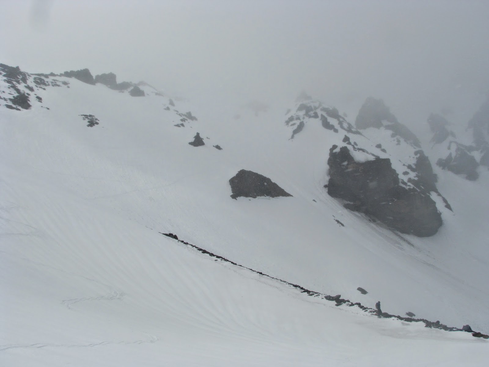
I skied up the crater until the angle steepened too much, then stepped on the snow, broke through the crust, and sunk up to my waist. Luckily a nearby fan of rime debris provided firm footing and I carried my skis cramponless up the 45 degree neve to the base of a rock buttress beneath the Eleven O'clock Couloir. There I dug a platform and put on my pons and harness. I stashed my skis and started up the firm debris trail again, but before I could reach the rock the snow returned to breakable crust on waist deep fluff. I tried traversing but it only got worse so I down climbed to slightly lower angle snow and tried traversing right to the next rock buttress, hoping to find something solid enough to safely reach the rock and ice above. I had no luck and the wallowing was so prohibitive that I actually lost elevation traversing. Halfway across the snow field I looked up and considered how ridiculous the whole thing was. I didn't think an avalanche was likely but I'd seen one in this exact same place before and I knew from floundering in the stuff that if it did slide it would be so big no one would find my body until August. More importantly, it was impossibly frustrating and my boots were half filled with snow, making it no fun. Deciding it wasn't worth it, I fought my way back to my skis and descended to more level snow.

The moon was obviously out of alignment, as I didn't have any luck, but it sure looked pretty over Bachelor in the predawn.

Sunrise happens fast... but not fast enough when you can't feel your toes.
I skinned over to the west side of the crater and then back to the east side, looking for something accessible, trying to find some justification for coming out there. Tired, cold and hungry, I ate a granola bar and waited for first light before skiing back to my tent. I packed and skied vigorously for a couple miles until my feet warmed up. I thought the worst was over once the sun rose and I was warm enough to skin in my t-shirt, but within a mile of the car a cloud rolled in and a mini-inversion on Dutchman Flats left me shivering and coughing. I reached the car around 9:45 to find my extra water and food frozen solid. I drove into town and gorged on deli food from Devore's before going home to spend the afternoon as a sleep-deprived zombie. Overall, I was annoyed that I wasted a weekend doing something so worthless, but you have to try to succeed and in the end it's all training anyway.

Sunrise behind Ball Butte.
Ditto... I expected a chorus of angels but the heavens were silent.

Monday, February 10, 2014

Stuck in the Snow

We finally started getting the winter everyone wanted here in Bend. It started by dumping beautiful dry powder in the mountains and I responded by heading up between work shifts and running several laps on the Tumalo bowl. I did seven laps, plus skiing to and from the car in roughly 4.5 hours. Which I think is pretty good. I remember hearing that 45 minutes is a good time for a lap on the Tumalo bowl, I was averaging around 27 minutes a lap and surprisingly didn't feel too tired afterwards.

Tumalo Bowl pow slayin'

Then the snow storms pushed down into Bend and things got a little crazy in town. The roads have been pretty terrible and I could force my way to the mountain but honestly I feel pretty unmotivated to bounce along in 4WD behind a bunch of other cars as we crawl up to the mountains. Instead I took advantage of the rare two plus feet in town and skinned from my apartment to Pilot Butte (a state park in town that involves a road and trail to the top of a 500 ft butte with nice views). I met another skier, Nick, en route and by the time we got to the summit it was obvious we weren't the only ones with this idea. It seemed like everyone with a back country setup had the same thought. I counted at least seven different groups skiing or boarding off the summit, several with GoPros... go figure. The ride was short and a little rocky but enjoyable, honestly it needs a proper base and a steeper slope with this much powder.

Pilot Butte summit

Skinning home after Pilot Butte

The next day I went to the Bend Rock Gym, which just opened a big expansion. I had tweaked my wrist earlier in the week trying to climb a surprisingly good thin hands and ratchets crack they have installed in the gym. It seemed like easy climbing didn't bug it though so I just started running auto-belay laps. I ended up climbing 1,540 ft, climbing up and back down 26 routes, in under two hours. I did most of it in two 45 minute blocks where I never got off the wall and simply traversed between auto-belays, tagging the ground and the top of the wall on each lap. I then started thinking how Honnold and Florine climbed 3,000 ft on the Nose in 2.5 hours with much of it run out simul/solo 5.10. That makes me really appreciate big wall speed climbing!

http://bendrockgym.com/

Anyway, in short I'm stuck at home between weather and other obligations for a couple weeks at least. I'm psyched for the opportunity to climb High Noon on Broken Top now that there will be less rock exposed. I also can't wait to get back on Hood and climb Reid Glacier Headwall and the North Face. But in the meantime, I'll be running, lifting, climbing and ski touring because I'm obviously still weak and pathetic.

Monday, January 20, 2014

The "Most Difficult" via The "Most Interesting"

It was a three day weekend so I felt compelled to attempt a big mission in the mountains. Unfortunately the snow conditions were terrible and it was way too warm for ice. Sounds like late spring right? So instead of trying a real winter climb that probably wouldn't go, I decided to try a late season mountaineering route instead. A la Jeff Park Glacier on Mt. Jefferson, AKA the "most interesting route" on Oregon's "most difficult summit." Jeff Park Glacier is a big, crevassed glacier on Jefferson's north side that flows from the ridge between two impressive rock pinnacles. The route follows the glacier to this ridge and then traverses a knife edge of low fifth class rock to the north ridge and the base of the summit pinnacle.

The Jeff Park Glacier, shadowed from evening alpenglow, as I hike up to my campsite Saturday evening.
I packed up the car and left Bend at noon on Saturday. The forest service road to the Whitewater Trail Head is mostly clear, thanks to the pitiful snow fall this winter. I was able to drive to within a mile of the trail head parking lot before my tires started spinning too much and I was forced to park. I left the car at 2pm, the road had good snow cover for skiing but the trail itself was mostly snow-less, forcing me to pack the skis. After the initial switch back section the snow reappeared and I was able to ski again. Once above Jeff Park (the hanging valley beneath the glacier) the snow became too icy for skins and I was forced to pack the skis again. I eventually made camp somewhere between 7000 and 7500 ft. in an icy depression. I fired up the stove and soon had plenty of water and a watery, warm bowl of curried rice and lentils. I crawled into my sleeping bag and turned the headlamp off at 8pm.

Sleep mostly evaded  me and I finally gave up and got up just after 3am. I melted 3 liters of water for the day and "cooked" some instant oatmeal with tepid water. After loading my pack and securing the tent with some big rocks, I started hiking at 4:30. There was a mostly full moon and I enjoyed hiking up the glacier without artificial light. Most of the crevasses were pretty well covered; I only punched through on one of them and it was obvious and small. The glacier has two bergschrunds, large crevasses caused by the glacier breaking away from snow pack above it. The first one was intimidating and took some time to get around in the dark, but I eventually located a good snow bridge. The second appeared more ominous, as there was tons of spindrift blasting over it, but in the end it was quite easy. I reached the top of the glacier at 6:15, 1:45 to climb ~2500 ft with some route finding issues. Not bad time, if I do say so myself.

The knife edge ridge traverse is called low fifth class rock climbing. I had read that there was a lot of exposure on it, and maybe it was scarier in the moonlight, but wow, big exposure is right. It was definitely an amazing perch; very narrow with several hundred feet of sheer drop on either side to steep snow slopes. The ridge crest also had a fair bit of snow and rime on it, so I ended up riding it horsey style quite a bit. This definitely made it the most awkward "rock" climbing I've done to date. The crux was a little tower on the ridge that was coated in rime ice. I climbed up just right of the crest and then had to down climb steep snow and rock on the back side. After the tower one more short horse ride led to the mellow north ridge. From there it was mostly walking, with only a short rime/rock down climb off a little nob, to reach the summit pinnacle.

Looking back on the knife edge ridge, leading to the snowier north ridge, from the summit. I didn't take any pictures before reaching the north ridge since it was dark.
By now the sun was peeking over the horizon and illuminating the east face. Being perhaps a little cocky I had thought that I would probably just reverse the whole route to descend, but I had no desire to hump my way back along the knife edge. The other descent option, which I hadn't really researched, was the East Face route. Now looking down the illuminated face I could see lots of very steep snow broken by cliff bands and getting warmed by the sun. This didn't look like a good idea either and given the extra time it would take to climb the summit pinnacle it would just get worse. I looked down the west side of the mountain at what I have since learned was the North Milk Creek Gully. This was still in the shade and I could see what appeared to be snow slopes, unbroken by rock bands, traversing around to the ridge above the Russel Glacier, a smaller, less steep ice field that parallels the Jeff Park Glacier. With this as my tentative descent plan I focused on the summit.

Sunrise paints the east face of Jefferson, and the Whitewater Glacier beneath it, pink.
The sun, just peeking over the horizon.
The north end of the summit pinnacle is a fourth class scramble in summer, now it was coated in thick, icy rime. Long lances of the stuff, upwards of three feet, had turned into solid ice blobs, probably as a function of the warm weather, and were sticking out of the snow at a downwards angle. Trying to find solid pick placements and move through them with a pack on was a slow process. There was only so much I was willing to bash off above me since the chunks were so large. I started by climbing a short chute to a hanging snow/ice field. From here I tried three different chutes leading up to the summit. I down climbed from part way up all three, feeling that they were too insecure and dangerous. I thought that maybe conditions just weren't good and that I would be denied after coming to within 30 vertical feet of the summit. However, I investigated one last gully, hidden around a corner to the far right. It looked doable, with some protruding rock holds, so I started up. I was able to traverse further right to the ridge crest and one final body length of rime climbing got me to the tiny summit (barely big enough for one person to sleep on). I took some photos, ate, drank, and admonished myself to descend carefully ("no mistakes, take your time"). The down climbing went smoothly and I was daggering backwards down the North Milk Creek Gully by 8:20.

My boot prints on the summit with the north ridge on the left and Mt. Hood on the horizon.
A close up of Mt. Hood, with Adams just visible to the right.
Looking past the South Horn from the summit (North Horn). Visible L-R are Black Butte, Broken Top, the Sisters, Mt. Washington, and Three Fingered Jack.
The shadow of Mt. Jefferson shades the knife edge ridge and the horizon, taken from the summit.
The "mandatory" summit selfie with Mt. Hood visible to the right.
The snow traverse over to the top of the Russel Glacier ended up being pretty continuous traversing on 40-45 degree snow. I crossed multiple gullies but only saw one ice chunk falling down. The last gully I climbed up instead of over to avoid steeper snow. This brought me to the ridge crest above the Russel, and to my relief I could see easy, walkable snow slopes all the way down. I may have even shouted with glee, knowing with certainty that the difficult parts were over and it was all clear sailing back to camp.

Looking back up at the summit pinnacle (right), the Mohler Tooth (left), and the gullies I had traversed, from the top of the ridge above the Russel Glacier.
Sunshine! I could not have imagined better weather. The summit pinnacle is on the left.
Looking down the ridge line with the Russel Glacier on the right... easy walking at last!
I reached camp around 10am, just in time to see two other climbers descending from the Jeff Park Glacier, the first people I had seen since turning my car off the main road the day before. We stopped and chatted for a bit and I found out they were from Portland and had been camped just over the moiraine from me but we had never seen each other. They had also tried the Jeff Park Glacier route but turned around part way up the glacier due to crampon malfunctions. After they started hiking down I crawled into my sleeping bag and ate a snack. I briefly considered taking a nap but decided I'd rather get out of the cold shade of the mountain and down to that nice sunny weather I could see. I packed up and skied out without incident, returning to the car by 1:30. I stretched and ate a fresh apple on a sunny rock before driving home.

Looking back at the Jeff Park Glacier from camp.
Amazing, rolling cloud formations above the Russel Glacier as I break camp.
Looking back at the mountain as it socks in with clouds during my ski out to the car... perfect timing.
Although this route was technically a couple notches easier than my Devil's Kitchen Headwall solo it was, in my opinion, a much harder climb. The constant accumulation of small, technical obstacles with big exposure, combined with the route finding issues and the uncertainty of whether or not it would go, made it a huge mental challenge. It also required a lot of my accumulated skill and experience to successfully navigate all the different parts of the climb. While the knife edge was definitely the technical crux, and the scariest section, the summit pinnacle provided the biggest challenge with its route finding. The most enjoyable part of the climb however, was the traverse over to the top of the Russel Glacier. Pushing an unknown descent path down an unknown (to me) part of the mountain was stressful but also very rewarding and I really enjoyed the sense of exploration. Finally, I'd like to thank some people, because a good solo effort is (ironically) only possible with the support of your partners... Edward, for taking me on those early mind expanding climbs and showing me what you can achieve with a level head. Travis, for being psyched to go climb in the alpine and first suggesting that Jeff Park might be soloable in winter. Lastly, Caitlin, for accepting, supporting, and trusting me not to do anything stupid. Thank you!